Public rights of way are very important to the walker.
Finding Rights of way
Links are provided for your convenience but information may not always be accurate or up to date. (You should always check on the Councils definitive maps)
ROW maps.com cover much of the country. ROWMaps.com
Bedford Borough council map showing Rights of way and other facilities. Follow this link Bedford Borough Council. click “agree” at the bottom of the page then when you see the map select “Rights of way” from the pull down menu on the left.
Central Bedfordshire Council Central Beds ROW map
******************
Reporting Problems.
If you find a problem with a Right Of Way contact the relevant local authority direct but please also let us have the details for our records. bedfordramblingclub@gmail.com
Bedford Borough Council:- If you have found a problem with one of the rights of way please either email or telephone. Important details to include are the precise location, the nature of the problem and additional contact details.
All enquiries please email Highways. Helpdesk@bedford.gov.uk or Tel: 01234 718003 or write -address: Room 436, 4th Floor, Borough Hall, Cauldwell Street, Bedford, MK42 9AP
Links to other local councils
Buckinghamshire County Council (new window)
Cambridgeshire County Council (new window)
Central Bedfordshire Council (new window)
Northamptonshire County Council (new window
Bedford Borough council ROW guidance for farmers and landowners
Right of way issues raised by the club.
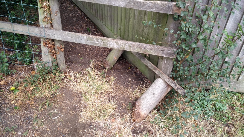 Wootton Footpath 27 – Keely Lane to Wood End Lane.
Wootton Footpath 27 – Keely Lane to Wood End Lane. Broken Stile in dangerous condition at Keely Lane end. (TL005460)13/8/20 Reported
21/8/2018 Informed that Council had written to Landowner
10/9/2018 Resolved. Stile had been completely removed.
*****************************
Kempston Rural footpath 18 / Wootton footpath 26 – Wood End Road to Keeley Lane. (SP998464 – SP999463) No signs or access to this footpath at either end.
16/8/2018 Reported
17/8/2018 Advised case given report no 21179
5/12/2018 After chasing several times I was advised that this path was effectively lost in 1993 when due to a planning error permission was granted for a building which blocked access to the path from Wood End Road. There is no chance of getting it reinstated now.
*****************************
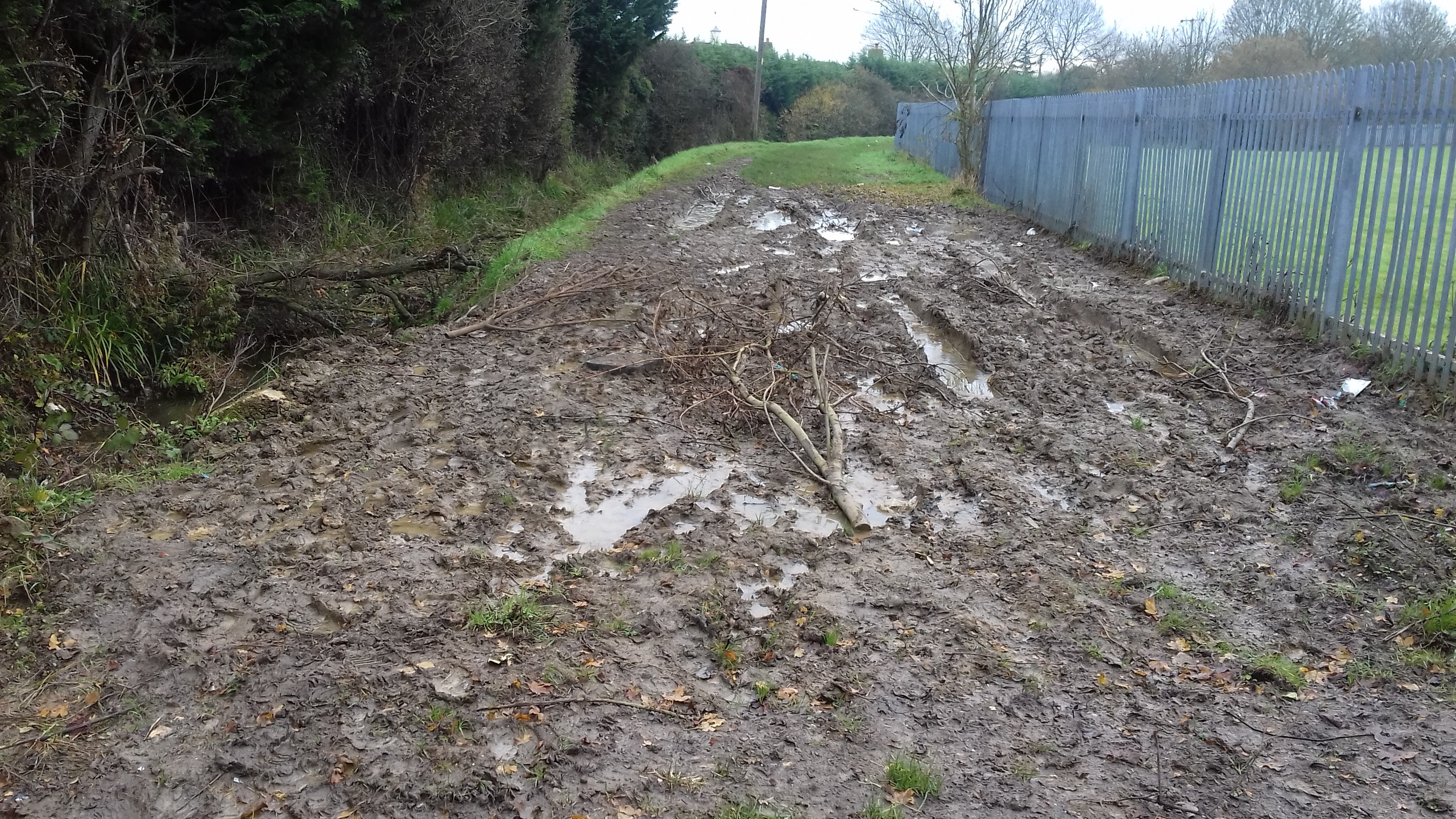
Bedford footpath 31
21/11/2019 Reported
November 2020 Grass now growing. Situation much improved.
Renhold footpath 20 Reported 15/11/2021
Thank you. Your case reference number is CAS-42241-W3F9V1
Here is a recap of your answers:
| Report Details | |
|---|---|
| Please provide further details about where the problem is. | Renhold footpath 20 appears to be “incorrectly” signed. |
| Please provide any other information you think will help solve this problem. | Renhold footpath 20 from the top of Wood field lane going North through Woodfield farm appears to be “incorrectly” signed from both directions to follow the route shown in yellow from points A to B on the attached map rather than the route shown for footpath 20. Can you please advise if this is an approved diversion and if it is not take any necessary action for it to be properly signed |
